Both Northshore and Lake Washington school districts are already closed for tomorrow. We're expecting record low temperatures tonight, and the possibility of more snow (eh, probably rain) tomorrow night. So I get to have hubby-Eric home another day! And I'm willing to bet a LEGO set that I'm not getting new comics tomorrow. Nor am I likely to attend my weekly swim tomorrow night. More time on the exercise bike... *sigh*.
I don't have cabin fever yet, but I'm sure it'll arrive if I stay stuck in the house long enough. I'm not willing to try driving on the ice without a really good reason. Unfortunately, I'm running out of one of my prescriptions, so going out before the week is up will have to happen. I just hope to wait long enough to expect someone to be at the pharmacy when I get there.
The National Weather Service has two advisories up for our area. The first is a Special Weather Statement about tonight:
...RECORD COLD TEMPERATURES ARE LIKELY TONIGHT AND WEDNESDAY MORNING..It goes on to report where the records will be broken, then gives a bit of advice:
ARCTIC AIR HAS SPREAD INTO ALL OF WESTERN WASHINGTON. AS WINDS DIE DOWN TONIGHT AND SKIES CLEAR... EXPECT STRONG RADIATIONAL COOLING OVERNIGHT... ESPECIALLY IN LOCATIONS WHERE THERE IS SNOW ON THE GROUND.
TEMPERATURES IN COLDER WIND-PROTECTED VALLEYS WILL LIKELY DROP WELL INTO THE SINGLE DIGITS. EVEN NORMALLY WARMER LOCATIONS LIKE SEATAC AIRPORT WILL DROP TO 15 TO 18 DEGREES OVERNIGHT.
PEOPLE ACROSS WESTERN WASHINGTON SHOULD MAKE SURE THAT EXPOSED PIPES ARE INSULATED... KEEP PETS INDOORS AS MUCH AS POSSIBLE... AND DRESS IN LAYERS IF YOU NEED TO VENTURE OUTDOORS.Yeah, kids in the Pacific Northwest are trained in dressing in layers from the moment we can dress ourselves, so that's not a problem. I'm in layers right now. Anyhow, that's tonight. Cold and clear. And icy where there was wet a few hours ago. It'll start to thaw tomorrow at some point, I'm sure, but there is a Winter Storm Watch on for tomorrow night:
THE NATIONAL WEATHER SERVICE IN SEATTLE HAS ISSUED A WINTER STORM WATCH FOR MOST OF WESTERN WASHINGTON... WHICH IS IN EFFECT FROM WEDNESDAY EVENING THROUGH THURSDAY MORNING. THE WATCH INCLUDES THE URBAN CORRIDOR FROM CHEHALIS NORTH THROUGH THE SEATTLE METRO AREA... EVERETT... AND BELLINGHAM."Highly Uncertain". We don't know if it's going to rain or snow tomorrow night. Thursday could dawn as a normal Seattle rainy day... or we might be completely snowed in and have no school yet again. I'm betting on the rain, personally, because I don't expect that hubby-Eric will get another day off (or me, for that matter). Whether it is snow or rain, it will break the all-time record for precipitation in a single month in Seattle of 15.33 inches set in 1933. We're only a tenth of an inch from the record right now, from last I heard.
A VERY COLD ARCTIC AIR MASS HAS SETTLED OVER WESTERN WASHINGTON BRINGING SUB FREEZING TEMPERATURES TO MOST AREAS. AN APPROACHING FRONTAL SYSTEM WILL SPREAD MOISTURE OVER THIS COLD AIR WEDNESDAY NIGHT AND THURSDAY MORNING CREATING A WINTRY MIX. PRECIPITATION SHOULD BEGIN AS ALL SNOW... FIRST AT THE COAST EARLY WEDNESDAY EVENING...SPREADING INLAND LATER IN THE EVENING. AS WARMER AIR MOVES INTO THE AREA LATE WEDNESDAY NIGHT INTO THURSDAY MORNING... SNOW WILL LIKELY CHANGE TO A MIX OF RAIN...SNOW AND POSSIBLY SLEET OR FREEZING RAIN. THE WINTRY MIX WILL TAPER OFF MIDDAY THURSDAY AS THE FRONT MOVES ACROSS THE AREA.
AT THIS TIME...SNOW OR ICE ACCUMULATION REMAIN HIGHLY UNCERTAIN. IT WILL DEPEND ON HOW QUICKLY WARMER AIR ALOFT MIXES DOWN TO THE SURFACE.
A WINTER STORM WATCH MEANS THERE IS A POTENTIAL FOR SIGNIFICANT SNOW... SLEET... OR ICE ACCUMULATIONS THAT MAY IMPACT TRAVEL. CONTINUE TO MONITOR THE LATEST FORECASTS FROM THE NATIONAL WEATHER SERVICE OR YOUR LOCAL NEWS SOURCE.
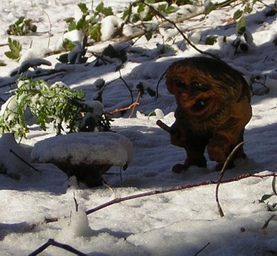
Well, I'm tired of the same old boring pictures of the yard covered in snow, so how about a picture of Torvald and a mushroom in the snow?

Update: Yup, we're on the way to breaking the record for Seattle rainfall in a month (emphasis mine):
Seattle needs less than one-tenth of an inch of precipitation by Thursday to break a 73-year-old record for the wettest month in history, according to the National Weather Service. As of midnight, 15.26 inches had been measured at Seattle-Tacoma International Airport, said meteorologist Johnny Burg. That means we need just 0.08 inches to exceed the 15.33 inches measured in December 1933 at the Federal Building in Seattle, where records span the 1890s to 1960s. The service began measuring rainfall at the airport in 1945.For another amusing look at Seattle weather, check out this primer explaining that, yes, it's possible to get thunderstorms and snow at the same time (both phenomena are rare in this area).

0 comments:
Post a Comment